Hammering Home: Why Hurricanes Hit the Southern Coast
Each hurricane season, residents of the coastal Southeast scan weather forecasts with a worried eye. But have you ever wondered why hurricanes hit the East Coast more often than other places, such as the West Coast? The answer lies in a complex combination of geography, ocean currents, wind patterns, and atmospheric dynamics.
A Warm-Blooded Storm
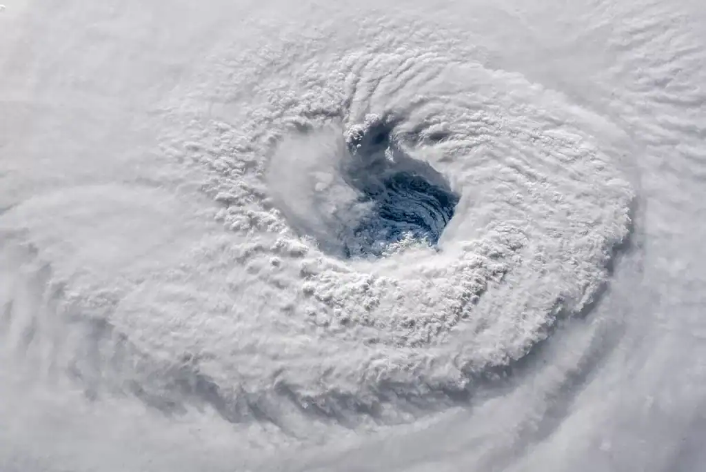
First, we need to learn what hurricanes are and what fuels them. Hurricanes, also called tropical cyclones or typhoons, are massive, rotating storms that form over warm ocean waters. They need a sea surface temperature of at least 80 degrees to develop and strengthen. Warm water acts like fuel, evaporating into the atmosphere and rising to form powerful thunderstorms. These storms begin to spin due to the Earth’s rotation (the Coriolis effect), and if conditions are right—low wind shear, enough moisture, and a pre-existing weather disturbance—a hurricane is born.
The Atlantic Hurricane Nursery
Most Atlantic hurricanes form in a region known as the main development region (MDR), which stretches from the west coast of Africa across the Atlantic to the Caribbean Sea. This area has warm waters, consistent easterly winds, and a relatively low level of atmospheric turbulence—all perfect for breeding hurricanes.
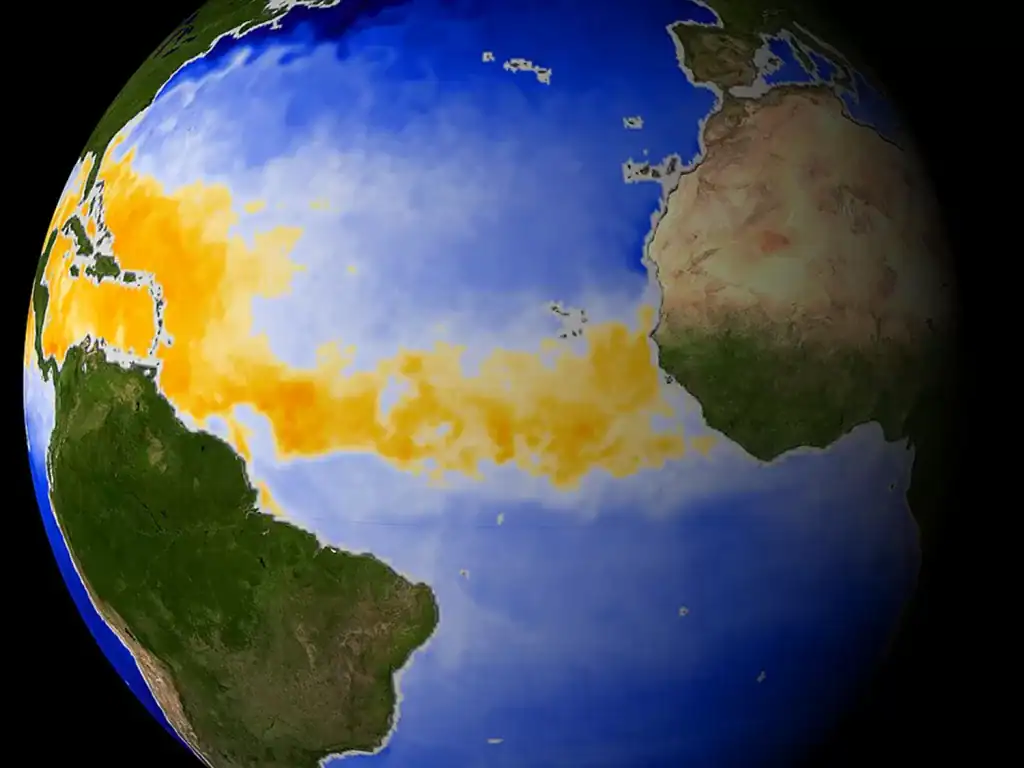
Many of these storms begin as tropical waves, or an area of low pressure in the atmosphere, which move westward off the coast of Africa. Once these storms reach hurricane status, trade winds near the equator – which blow from east to west toward the East Coast of the United States, the Caribbean, and the Gulf of Mexico – carry them westward.
A jet stream, which is a high-altitude river of air, can either steer storms away or pull them toward the coast, depending on its position. Sometimes, a blocking high-pressure system over the Atlantic (known as the Bermuda High) prevents hurricanes from turning northward, forcing them to continue straight toward the United States’ coastline.
The shape and orientation of our coastline also play a role in hurricane impact. The East Coast juts into the Atlantic, making it and its coastal cities more exposed to westward-moving storms.
The Gulf of Mexico: A Hurricane Magnet
Not just the Atlantic Coast is vulnerable. The Gulf Coast, from Texas to Florida, is one of the most hurricane-prone areas on Earth. The Gulf of Mexico is like a giant bathtub of warm water, often reaching temperatures well above 86 degrees in late summer.
Hurricanes which enter the Gulf can rapidly intensify as they feed on these warm waters. With little room to escape, many of these storms eventually hit land somewhere along the Gulf Coast. Historic hurricanes like Katrina (2005), Harvey (2017), and Ida (2021) all gained strength in the Gulf before making catastrophic landfall.
Why Not the West Coast?
While the eastern Pacific Ocean actually produces a similar number of hurricanes, they rarely make landfall on the West Coast. This is because of its cold California Current, which flows southward from Alaska, and the Pacific subtropical high, a semi-permanent high-pressure system that forces storms westward out to sea rather than toward land.
A Big Draw: The Southeast Coast
Hurricane hotspots on the East Coast include Florida, the most hurricane-prone state because of its exposure to both the Atlantic and the Gulf; North Carolina, where its Outer Banks are vulnerable to storm surges; and South Carolina, where Hurricanes Hugo (1989) and Matthew (2016) particularly wreaked havoc. New York & New Jersey are less frequent targets but still at risk, as seen with Sandy (2012).
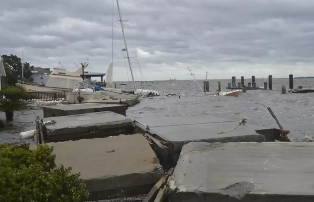
Although Camden County is low-lying and exposed to winds from the east, its mainland is protected from wave action by Cumberland Island and its marshes, even if they do not stop heavy flooding and strong winds. Hurricane Irma was the area’s most recent catastrophic storm, causing extensive damage or total destruction to the docks at St. Marys’ waterfront, including the Cumberland Island ferry dock. It also damaged dozens of boats anchored offshore and caused floodwaters to penetrate buildings on the city’s waterfront.
Now that you know the Southeast Coast is a victim of its location – at the end of a pipeline of warm water and westward winds that start thousands of miles away – how can this knowledge help you prepare for the next hurricane? Well, it can’t. But at least you now understand better why the next hurricane may target us!
Learn more about Southeast Georgia’s unique nature and history on a tour! Join our Cumberland Island Walking Tour: Haunting Ruins and Wild Horses or our Fugitives, Fighters, and Fudge: St. Marys Walking Tour!